|
Node Type
|
Description
|
|
|
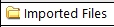
This is the imported files node.
|
|

|
This is a station node.
The icon represents the survey instrument type. It is followed by the point ID and an "S" number in parenthesis that uniquely identifies the station.
|
|

|
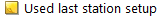
This is the station setup node.
The icon is followed by the setup type (in this example, "single backsight") and the associated backsight point ID(s) in parenthesis.
Nodes displayed beneath this one are typically coordinate and azimuth nodes, which show data that was keyed in during station setup.
|
|
|
This is a note node.
The icon is followed by the first few words of the note.
|
|

|
This is a coordinate node.
The icon is followed by a coordinate point ID.
This node is typically displayed beneath a station setup node.
This is a coordinate node from a benchmark. The icon is followed by a coordinate point ID.
Note: To preserve the integrity of raw field data, you cannot edit coordinate properties for an imported coordinate displayed beneath the Imported Files node. However, you can edit coordinates displayed beneath the Points node.
|
|

|
This is an azimuth node.
The icon is followed by the occupation point ID, a dash, and the observed point ID. This is followed by an "A" number in parenthesis that uniquely identifies the azimuth.
This node is typically displayed beneath a station setup node.
|
|
|
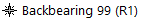
This is a backbearing node.
The icon and name are followed by the point ID of the first backsight point. This is followed by an "R" number in parenthesis that uniquely identifies the backbearing.
Nodes displayed beneath this one are typically related observation nodes.
|
|

|
These are face 1 and face 2 total station observation nodes.
The icon is followed by the occupation point ID, a dash, and the observed point ID. This is followed by a "T" number in parenthesis that uniquely identifies the observation.
|
|
|
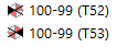
These are face 1 and face 2 backsight observation nodes.
The icon is followed by the occupation point ID, a dash, and the observed point ID. This is followed by a "T" number in parenthesis that uniquely identifies the observation.
|
|

|
This is a dual prism observation node.
The icon is followed by the occupation point ID, a dash, and the observed point ID. This is followed by a "T" number in parenthesis that uniquely identifies the observation.
|
|

|
This is a mean angle node. It represents the combining and averaging of redundant observations to the same point.
The icon is followed by the backsight point ID, a dash, the occupation point ID, another dash, and the observed point ID. This is followed by an "M" number in parenthesis that uniquely identifies the mean angle.
If the text is displayed in red, the mean angle includes one or more outlier observations (that is, the observations exceed tolerances specified in the Computations > Mean Angles tab in the Project Settings dialog). To disable outlier observations, right-click the node and select Mean Angle Residuals.
For more information on viewing and working with mean angles, see View and Edit Mean Angle Residuals and Run a Mean Angle Report.
|
|

|
This is a rounds node. The icon is followed by the word "Rounds".
Displayed beneath it are two or more sets of observations, which are represented by set nodes.
|
|

|
This is a set node. It is nested under a rounds node.
The icon is followed by the word "Set" and a number that identifies the set.
Displayed beneath it are nodes representing observations made during the set.
|