I assume you have bottom of trench/conduit design as linework and a FSL, and you want to set out offset pegs but write down the depth at the conduits location?
Access can't do that. You'd need linework that is draped onto the surface and then stake out to that line work.
Access also can't setout to two lines at the same time. You'd have to setout one of them as Alignment/Road and one as Polyline, and switch forth and back between both programs.
It is a huge drawback in comparison to Siteworks/SCS900 "Reference Line".
In Siteworks you could also choose
------------------------------
Ronny Schneider
------------------------------
Original Message:
Sent: 01-31-2022 17:01
From: James Barnett
Subject: Staking line work using a DTM elevation in ACCESS
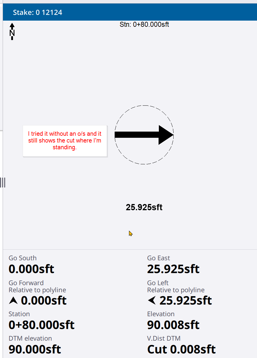
I guess I don't understand the instructions, because I do not get the DTM elevation at the line. I get it where my GPS position is. 


------------------------------
Tex Barnett
Surveyor
CEI Engineering Inc.
Bentonville AR
8705004286
Original Message:
Sent: 01-31-2022 15:30
From: James McWha
Subject: Staking line work using a DTM elevation in ACCESS
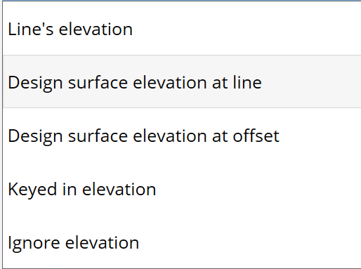
Yes this is possible. It needs to be set up in Options prior to staking the line. See the following section of the help for more details:
https://help.trimblegeospatial.com/TrimbleAccess/latest/en/Stake-show-cut-fill-to-DTM.htm
------------------------------
James McWha
Original Message:
Sent: 01-31-2022 15:20
From: James Barnett
Subject: Staking line work using a DTM elevation in ACCESS
I would like to give my field hands line work and a DTM then they can give a station offset horizontally to the line work with a cut/fill to the DTM where the line work is not to where they place the stake. Has anyone found a way to do this?
------------------------------
Tex Barnett
Surveyor
CEI Engineering Inc.
Bentonville AR
8705004286
------------------------------