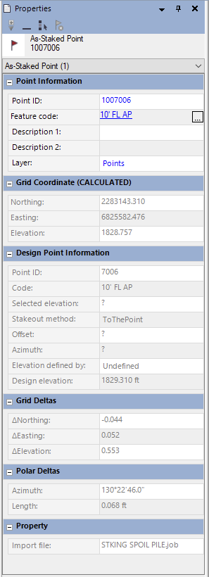
I am not sure if anyone has run into this issue before but we have had it happen on a couple of jobs. We did some GNSS stakeout in Access using an R10 base and rover setup. Upon exporting our custom stakeout report, no cuts/fills or as-staked elevations were populated and whenever we export the points as a CSV file, the as-staked points are not included (even after specifying "all points" to be exported). When we look at the points in the point manager, all the as-staked points have "?" in place of the grid coordinates and when you import the Job file into Trimble Business Center, the import summary says "The as-staked point XXXXXX has no computed grid coordinates..." and if you open the properties of one of the as-staked points, it shows a grid coordinate but says "(calculated)" after it. Has anyone else had this issue of as-staked point coordinates not being generated in Access and know of a fix?

------------------------------
Timothy Alldrin
------------------------------