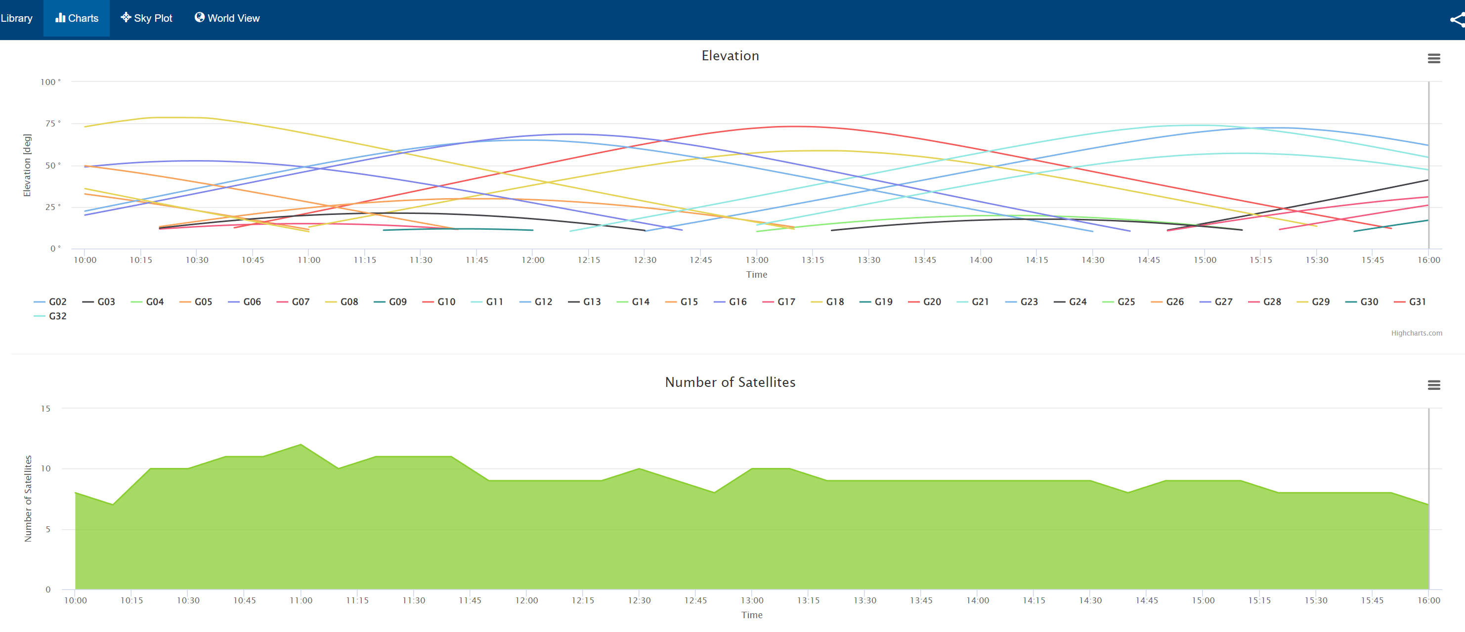
A major impediment to assessing the sky is allowing for a user to map the obstacles (obstructions) while planning a satellite observation. I'll show you an example using the Trimble Planning Tool (forever my favorite because you can draw an obstacle map) and the online tool (where that capability does not exist. In both screenshots, I'm planning for a GPS constellation only (OPUS submission), on the same day, same location, same block of time. You can clearly see the number of satellites is not a reality when, as I'm doing tomorrow is observing against a rock wall blocking the NNW to SE quadrant of the sky (near vertical).
As the years go by, Trimble planning executible will probably be not allowed to run on modern Windows. Since you have a Web App, why not offer the user the capacity to create an obstacle map. This comparison clearly shows how much the online tool is off from reality.
Thanks for the opportunity to post.
Trimble Planning

GNSS Planning Online
------------------------------
Joel Cusick
------------------------------