Looks like E and N are swapped.
Find one point with real life coordinates (global coordinates) that has local coordinates in your engineers custom coordinate system.
Calculate divergence angle for your global point.
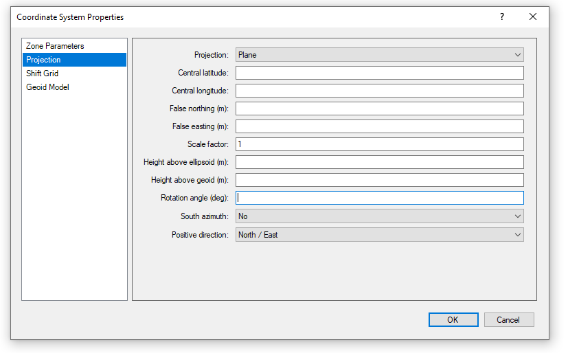
Create new coordinate system:
Planar,
Central Lat and Long are your global point
False easting and northing are your Local coordinates
Scale factor as needed, maybe be 1.000 may not be. You have to assess it based on the information you have.
Rotation angle will be 90 degrees + divergence angle (or 90 - divergence angle), or -90 + divergence angle... one of those will work.
Voila.
Import your DWG in local coordinate system.
Turn or background maps, check how they fit.
Compare with your control points.