Hi all,
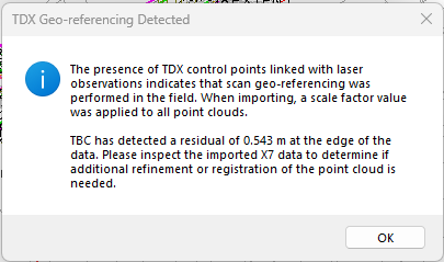
I have scanned a large road project with an X9, placing control every 100m with GNSS. I registered cloud-to-cloud in the field, then imported to realworks and refined using the control points captured in the scan (Adjust Registration using 'TopoPoints' survey control as the reference). This gave me a registered, on-datum (grid) point cloud with good residuals. My workflow is then to export a tdx from Realworks and into TBC to extract CAD features. However on importing the tdx I get the below message and TBC automatically scales my cloud. There is no pre-import dialog box like with a las import that asks if I want to scale.
Is there any way to stop this from occurring? For the moment I've just used a las but tdx is preferable as it preserves the panoramas and station views and the file size/import times are much better.
Thanks,
Zach