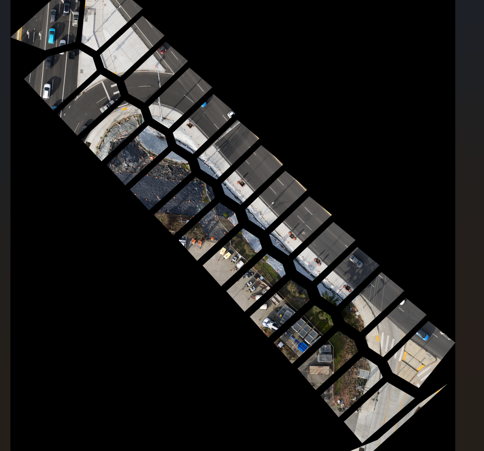
I'm trying to create Tiff files with orthoimagery. After processing the flight data and adjusting to GCP. I attempt to create my deliverable as an orthoimage, non compressed.
When I create it without any boundary it works great, but for some reason when I try and add a boundary line during deliverable creation it generates a tiff but the image is in pieces within the file.
Here is a snip of what I mean.
Lastly, I tried not having a boundary, but then creating one after. But I'm not sure how to export it as a Georeferenced image while maintaining its clipping.